JOHN KLIMA
|
JOHN KLIMA
|
| Stand-alone
EARTH
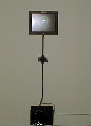
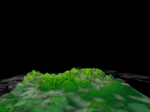
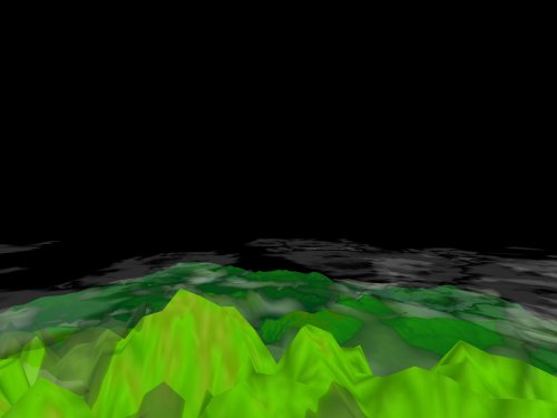
Stand-alone EARTH is a limited edition of software presented on eight multimedia objects. Stand-alone EARTH includes a 15" LCD monitor, a hand-crafted computer, and a trackball input device. The EARTH
software accurately
positions real-time data culled from the Internet on a
three-dimensional
model of the Earth. Viewers are able to travel from layer to layer by
zooming
in and retrieving imagery and data for specific regions. From the outer
to the inner layer, viewers encounter:
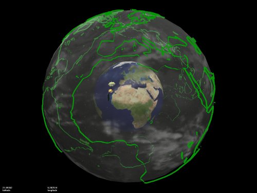
Presented as a complete hardware/software object, the entire dataset exposed in this version is cached on the hard-drive, and if the system has a live Internet connection, the cached data is suplemented by the current online information. Networked EARTH represents all the online viewers by positioning satellites, and indicates a "best guess" as to where that viewer is in reality, located on the planet. Courtesy of Postmasters Gallery.
|
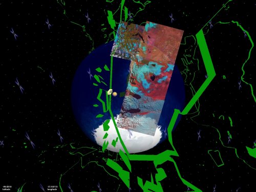
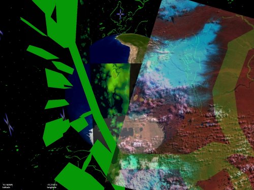 Landsat-7 close-up over Patagonia |
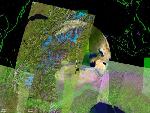 Landsat-7 over Europe |
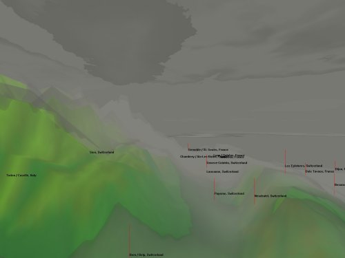 Terrain layer, Europe, showing weather stations |
 Terrain layer, Europe, overview |
 Terrain layer, Europe, overview |
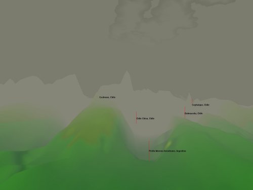 Terrain layer, Patagonia, showing weather stations |
< BACK
| Java browser
module
(beta version available
online)
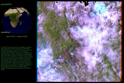
The simplest level of EARTH is the easily accessible Java browser module, a simplified browser-enabled version that shows the Earth from a high orbital view. The Java module only gives access to Landsat-7 imagery -- displaying a high resolution image of the location on the globe that the viewer is looking at in a seperate browser window. When a viewer enters the Java module, a small satellite in orbit around the Earth appears as a representation of this viewer within the stand-alone and EARTH projection versions. Satellite positions indicate the center of viewers' screens, exposing to the owners of the stand-alone EARTH what the Java viewers are seeing.
|
< BACK
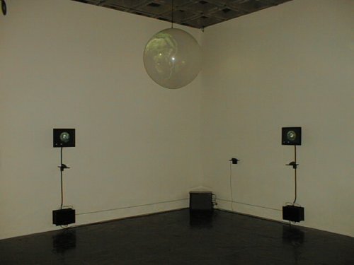
| The unique
EARTH projection
The unique EARTH projection (shown at the 2002 Whitney Biennial) is the final piece of the EARTH system. The installation consists of 2 stand-alone EARTH user stations and an overview projection. The overview
of EARTH
is projected on a translucent latex weather balloon, placing the
three-dimensional
EARTH rendering in the "real," three-dimensional world. The
projection has perceivable depth; the use of a weather balloon as a
projection
surface frees EARTH from the flatness of a two dimensional screen. The
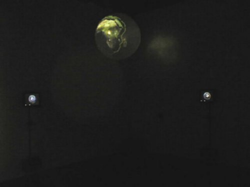
world
The overview projection on the balloon shows the whole Earth from the viewpoint of the outer layer. Visible on the sphere are the Landsat 7 images viewed by visitors in the museum (at the user stations) and by users of the Java browser module. The EARTH overview projection can be rotated with a trackball input device. Expanding upon
the networked
community of EARTH viewers, the projection not only indicates other
viewers
positions, it also displays the exact information they are currently
viewing.
It is the overview of the complete system, the "Big Brother" in an a
benign
informational universe, reminding us of the often frigtening nature of
the techno-informatic landscape developing in the real world, often not
for such benign ends.
|
< BACK